About the plugin:
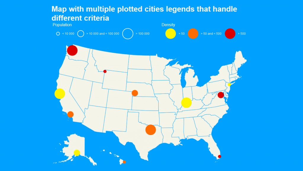
This is a nice and awesome jQuery Map Plugin with Mapael, in which you can display a map of the world with clickable countries. You can also build simple dataviz by setting some parameters in order to automatically set a color depending on a value to each area of your map and display the associated legend. Moreover, you can plot cities on the map with circles, squares or images by their latitude and longitude.
Features:
- based on jQuery and raphael.js. And optionally based on jQuery mousewheel for the zoom on mousewheel feature
- interactive: set href, tooltip, add events and many more on the elements of your map
- plottable cities Cities can be plotted on the map with circles, squares, images or SVG paths by their latitude and longitude
- areas and plotted points colorization with legends: Mapael automatically sets attributes like color and size to each area and plotted point displayed on map and generates an interactive legend in order to build pretty dataviz
- links between cities: you can draw links between the cities of the map. Easy to add new maps. Build your own maps based on SVG paths
- SEO-friendly: an alternative content can be set for non-JS users and web crawlers
- resizable: maps are easily resizable
- zoom: zoom and panning abilities (also on mobile devices)